Badey & Watson anticipates, addresses
and manages challenges to keep your
projects running smoothly.
WHAT SETS US APART
is our expertise and guidance in anticipating, addressing, and managing challenges that might delay your project.
We provide high quality, comprehensive surveying and civil engineering services, specializing in residential and
small commercial projects. We build on the trust we have established among local government agencies,
title companies, financial institutions and related professionals.
ABOUT BADEY & WATSON
Established in 1973 and certified as a WBE in 2016, Badey & Watson has built a long-standing reputation for integrity, innovation and reliability. Led by licensed Land Surveyors (LS) & Professional Engineers (PE), our respected staff of professionals provide a comprehensive array of surveying, mapping and civil engineering services for a growing family of clients including architects, developers, large civil firms, attorneys, engineers, construction firms, homeowners/residential, and state and local governments.
SERVICES

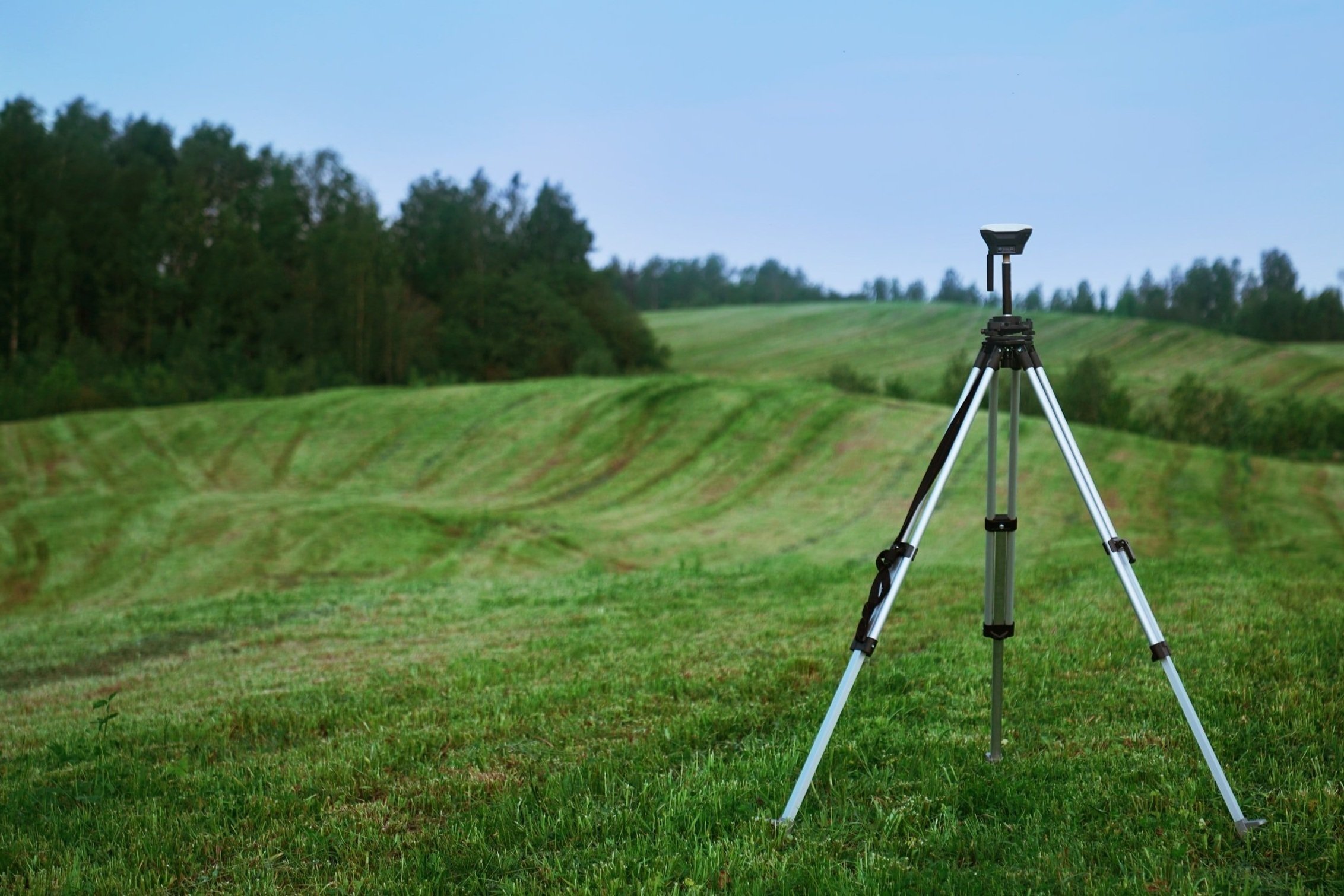
SURVEYING/MAPPING
ALTA/NSPS Title Survey
Boundary Surveys
Topographic & Existing Conditions Surveys
Global Positioning Surveys (GPS)
3D Laser Scanning
3D Modeling and Mapping
Municipal Infrastructure Inventory/GIS
Construction Layout
Zoning Reports
Subsurface Utility Investigation (SUI)

CIVIL ENGINEERING
Town and Planning Board Consultation
Land Use Regulation and Zoning Compliance Reviews
Site Analysis and Development
Commercial/Office Park Site Planning and Design
Stormwater Pollution Prevention Plan Compliance
Sanitary Facilities Design, Testing, Permitting
Water/Waste/Stormwater System Design

CERTIFIED ARBORIST SERVICES
Tree Identification,
Assessment & Mapping
Invasive Species Consulting
& Management
Bat Habitat Assessment & Report
Wetland Delineation & Mapping